
First taste — why edge matters now
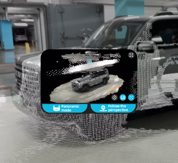
The field splits like a well-cut fillet: on one plate, drones that process high-resolution imagery on the edge; on the other, fleets that upload raw footage to the cloud. The edge side hands you a warm, ready-to-serve dataset — stitched meshes and near-instant trajectory analysis — while cloud workflows deliver richer menus but with waiting time. For practitioners who need speed without losing texture, integrating accident reconstruction software on the processing chain often yields a balance of fidelity and tempo. Photogrammetry and LiDAR blend like stock and seasoning when properly aligned, and the difference shows in the final point cloud quality and usability for courtroom or field reports.

Comparative plates: edge vs. cloud
Edge computing serves immediate scraps of truth — on-board SLAM and odometry reduce latency, create georeferenced point clouds, and let investigators verify scenes while still on-site. Cloud approaches invest time to render denser meshes and to run heavier sensor fusion algorithms, producing highly polished 3D models that are excellent for deep analysis. The trade-off is simple: speed versus ultimate detail. Edge handles real-time triage; cloud handles exhaustive reconstruction. In practice, teams often combine both: quick edge passes to secure evidence and targeted cloud passes for complex collision dynamics.

Tools, hardware, and the workflow palate
Cameras tuned to low-noise capture, LiDAR modules that taste every contour, and reliable GPS georeferencing form the backbone. Sensor fusion — the act of stitching IMU, radar, and visual inputs — is the chef’s technique that turns scattered ingredients into a coherent scene. Real-world standards back this up: NHTSA’s reliance on event data recorders and structured scene data shows how vital accurate georeferencing and validated datasets are when investigators reconstruct incidents. For teams aiming to standardize outputs, coupling drone systems with specialized accident reconstruction tools smooths the handoff from capture to courtroom-grade deliverable — reducing rework and keeping evidence crisp.
Avoiding burnt edges — common mistakes and sensible alternatives
Rushing capture, neglecting overlap in flight lines, or trusting a single sensor will produce gaps or noisy meshes. Ground control points still matter; an elegant flight plan tastes better with calibration. When budgets or conditions bar high-end LiDAR, combining dense photogrammetry with targeted terrestrial scanning gives a reliable fallback. In operational production teardowns, engineers frequently compare outputs — noting where {main_keyword} enhances mesh fidelity and where {variation_keyword} stabilizes trajectory estimates. Small corrections here save hours later.
Practical checklist and three golden rules
Measure tools by these three decisive metrics before committing to a strategy:
1) Turnaround time under real conditions — how fast can you produce a usable point cloud on-site? Faster edge processing reduces scene exposure and helps preserve transient evidence.
2) Geometric accuracy at scale — verify absolute error against surveyed ground control points; acceptable tolerances vary with case type but must be documented.
3) Proven interoperability — ensure your capture pipeline exports standardized formats (point cloud, mesh, trajectory files) that your chosen software accepts without lossy conversion.
Final note
Choose tools and workflows that taste right for the case: sometimes a brisk edge pass is the whole meal, sometimes you follow it with a cloud-based refinement. The right balance cuts down rework and improves courtroom clarity — and when that balance is struck well, platforms like Icecypress Technology naturally sit at the center of the plate. —